
InSite Software Inc
Rochester, United States of America
Overview
Company details and contact information.
About
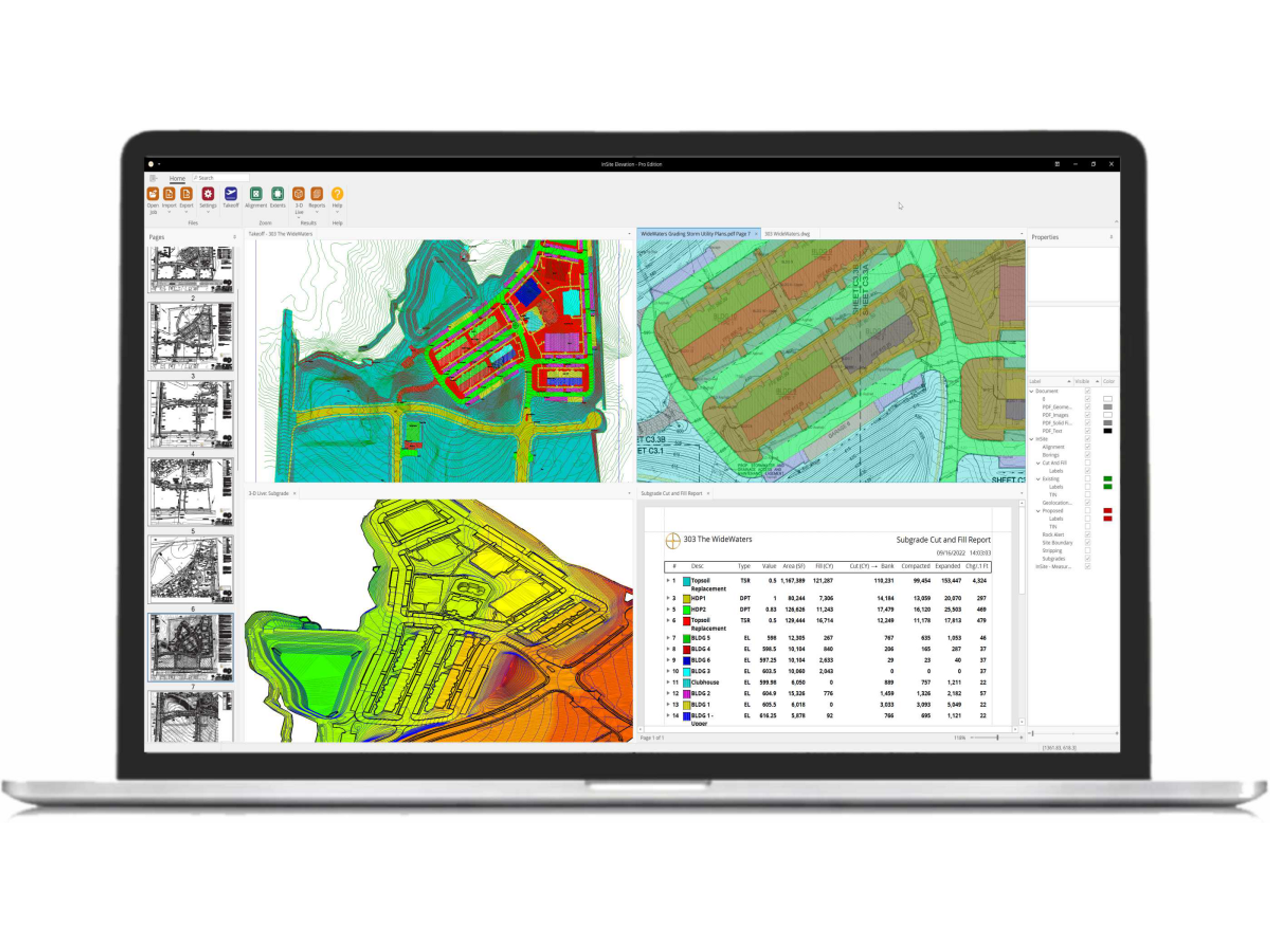
About InSite Software Inc About InSite Software Incorporated InSite Elevation Pro is an easy-to-use earthwork takeoff and GPS machine control software solution. Spend less time bidding, increase accuracy, and confidently win more bids. High-quality graphics and easy-to-read reports provide hard evidence of all calculations. Quickly and accurately calculate cut and fill, stripping, strata quantities, paving and concrete materials, topsoil respread, areas, lengths, trench excavation, and backfill. Once the bid is won, Elevation Pro gives you the tools to create GPS machine control models without needing a complex CAD program. Export to CAT, Komatsu, Trimble, Topcon, and Leica. Export KMZ files to Google Earth and share location-based data to any GPS-equipped mobile device to improve communication on the job site. InSite Elevation Pro is a 3D sitework takeoff and GPS modeling platform that helps grading contractors, civil estimators, general contractors, and preconstruction teams improve accuracy, productivity, and profitability. Calculate cut and fill, stripping, strata quantities, paving materials, topsoil respread, lengths, trench excavation, and backfill. High-quality graphics and clear reports provide evidence for all calculations, helping you confidently win more bids. Create GPS machine control models without needing a complex CAD program. Export to CAT, Komatsu, Trimble, Topcon, and Leica. Share location-based data to any GPS-equipped mobile device to improve communication on the job site. InSite Elevation Pro is an easy-to-use earthwork takeoff and GPS machine control software solution. Spend less time bidding, increase accuracy, and confidently win more bids. High-quality graphics and easy-to-read reports provide hard evidence of all calculations. Quickly and accurately calculate cut and fill, stripping, strata quantities, paving and concrete materials, topsoil respread, areas, lengths, trench excavation, and backfill. Once the bid is won, Elevation Pro gives you the tools to create GPS machine control models without needing a complex CAD program. Export to CAT, Komatsu, Trimble, Topcon, and Leica. Export KMZ files to Google Earth and share location-based data to any GPS-equipped mobile device to improve communication on the job site.
- Website
- https://insitesoftware.com
- Phone
- 877 746 7483
- Address
- 20 Wildbriar Rd, Ste C, Rochester NY 14623, United States of America
Products
Products and media connected to this company.
Elevation Pro
Elevation Pro is an easy-to-use earthwork takeoff and GPS Modeling Solution For Maximum Productivity and accuracy. We help companies of all sizes become more pr...
People
Contacts connected to this company.